Estimating horizontal decorrelation scales of ocean varilability - Lorna McLean
Previous studies have generally examined temperature anomaly or depth levels using XBT data from the upper few hundred metres of the water column. Using Argo, the decorrelation of salinity can be examined in either depth or temperature levels.
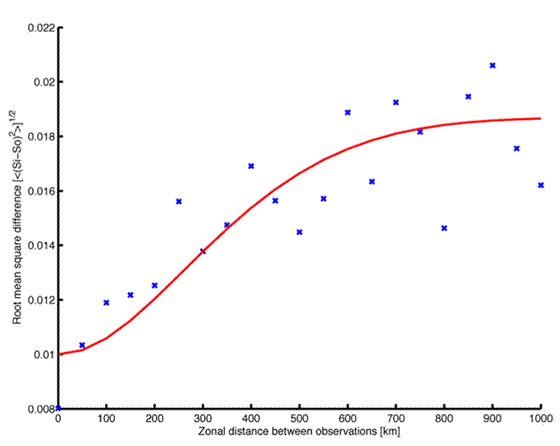
29 degree band
Floats profiles collected within 9 days and 2 degrees of latitude of one another are sorted into 50km bins of longitude. On the chosen level, the r.m.s. salinity difference between such pairs of floats is small when the zonal separation is small, and grows to a far-field value. The growth defines a decorrelation length scale.
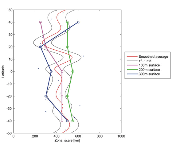
Zonal scales in Pacific surface layer (100-300m) including individual 20 degree band averages.
The length scale is examined as a function of latitude and depth. The one scale fits-all approach commonly used in assimilation and objective mapping can be improved upon. The panel above shows upper ocean levels in the Pacific, with no significant latitudinal variation. At deeper levels, there is a significant change between the scales inferred in the equatorial region and those at mid-latitudes (as shown by the panel below).
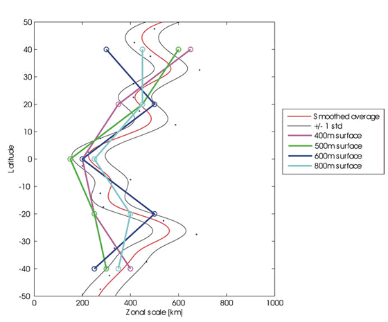
Zonal scales in the Pacific intermediate layer (400-800m) including individual 20 degree band averages.