![UK Argo [logo]](/themes/ukargo-NOC8X/logo.svg)
Argo is an international ocean observing programme that has been continuously collecting data from the global ocean since 2000 using a fleet of autonomous robotic instruments. These instruments, known as floats, spend almost their entire lifetime below the ocean surface.
Argo provides the observations needed to understand a changing ocean, improve weather and ocean forecasts, protect marine ecosystems, prepare for extreme events, and support decisions across climate, marine industries, security and civil protection.
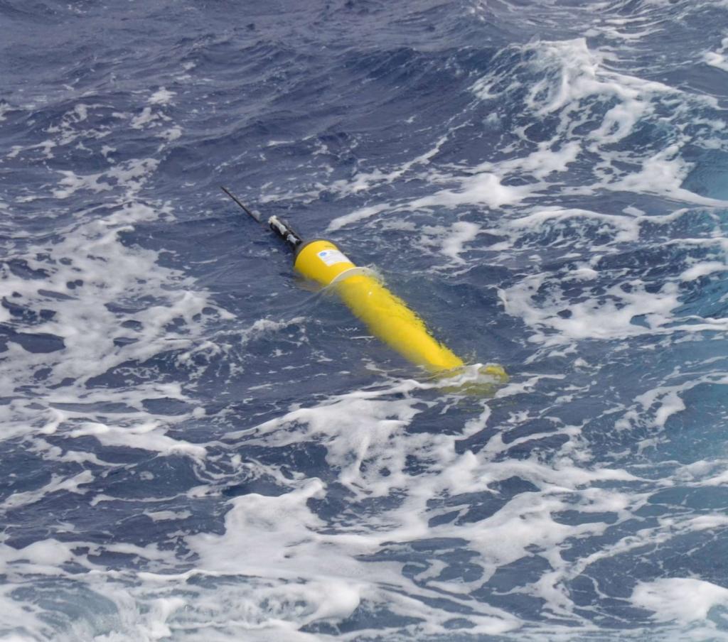
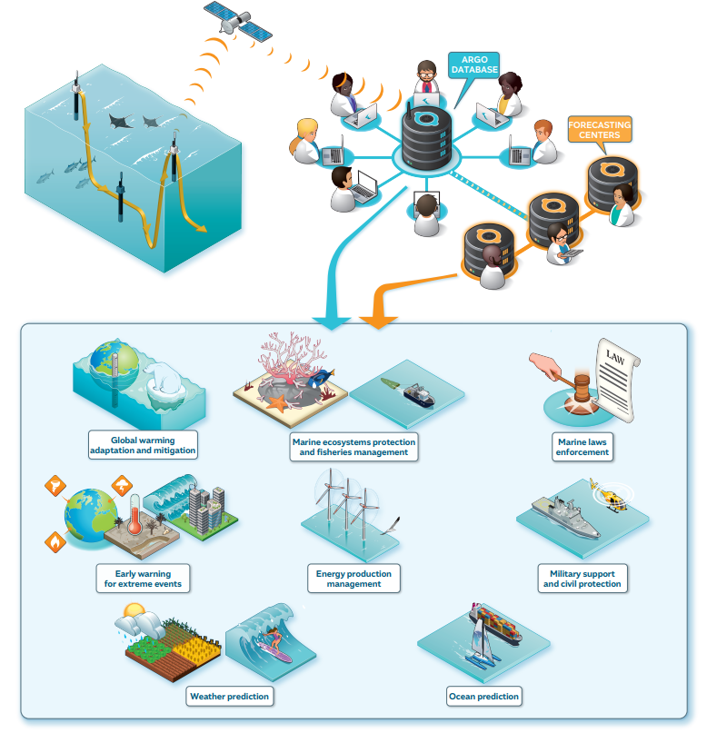
Argo is a cornerstone of the Global Ocean Observing System (GOOS) and the key source of sustained, global subsurface ocean observations. Currently, the Argo network consists of more than 4,300 active profiling floats that drift with deep ocean currents. Its autonomous profiling floats provide unprecedented spatial and temporal coverage of the upper 2,000 m of the ocean. Their measurements of temperature, salinity and pressure are transmitted via satellite after each profile. The observing network is further enhanced by Biogeochemical Argo floats, which collect measurements of variables including oxygen, pH, nitrate and chlorophyll, and by Deep Argo floats capable of sampling the ocean down to 6,000 metres.

Why does it matter?
Argo is a global ocean observing system that provides sustained, near-real-time measurements of the ocean from the surface to the deep ocean. By delivering consistent, high-quality observations of temperature, salinity and, increasingly, biogeochemical properties, Argo provides essential information for understanding a changing ocean. Combined with satellite observations, numerical models and other observing systems, Argo data underpin a wide range of scientific, operational and societal applications—from climate monitoring and weather and ocean prediction to ecosystem protection, extreme-event early warning and maritime activities.
Global warming: adaptation and mitigation
- Argo provides sustained observations of ocean temperature, salinity and heat content, helping scientists monitor ocean warming, sea-level change and changes in ocean circulation. These observations are essential for assessing climate change, improving climate models and informing adaptation and mitigation strategies.
Marine ecosystem protection and fisheries management
- BGC-Argo measures oxygen, nitrate, chlorophyll, pH, particles and light, providing information on marine productivity, ocean acidification and deoxygenation. These data help assess ecosystem health, understand changing habitats and support sustainable fisheries management.
Marine law enforcement and maritime governance
Argo contributes environmental intelligence for maritime surveillance, pollution monitoring and search-and-rescue operations through observations and ocean forecasts. It also supports international coordination of ocean observing activities, including the management of float deployments in national waters.
Early warning of extreme events
Continuous observations help detect and monitor tropical cyclone and hurricane forecasting; marine heatwave monitoring; extreme ocean temperature events; storm-surge and coastal-impact forecasting; unusual ocean circulation events. When combined with forecasting systems, Argo data improve early warning and preparedness for extreme events.
Energy production management
Information on ocean temperature, density and circulation supports offshore energy planning, environmental assessments and operational decision-making. It is relevant to offshore wind and other marine infrastructure, as well as wider marine industries.
Military support and civil protection
- Accurate information on currents, temperature and ocean structure supports search and rescue, maritime operations, emergency response and defence applications. Ocean forecasts can also help predict the movement and dispersion of pollutants or other hazards.
Weather prediction
- The ocean strongly influences the atmosphere. Argo provides critical subsurface observations that improve the representation of the ocean in weather and coupled ocean–atmosphere prediction systems, contributing to better forecasts from days to seasons.
- In the UK, Argo observations are used operationally by the Met Office's ocean forecasting systems. The UK Argo programme reports that Argo data are assimilated into the FOAM system, used in monthly-to-seasonal forecasts and in climate prediction, while coupled ocean-atmosphere systems use ocean information on weather-prediction timescales.
Ocean prediction
- Argo observations are assimilated into operational models to produce forecasts of currents, temperature, salinity, sea level and other ocean properties. These forecasts support shipping, fisheries, offshore industries, environmental management, search and rescue and many other marine activities.
![Figure: Application of Argo data. (credit: Euro-Argo Eric)]()