Global Argo Data System
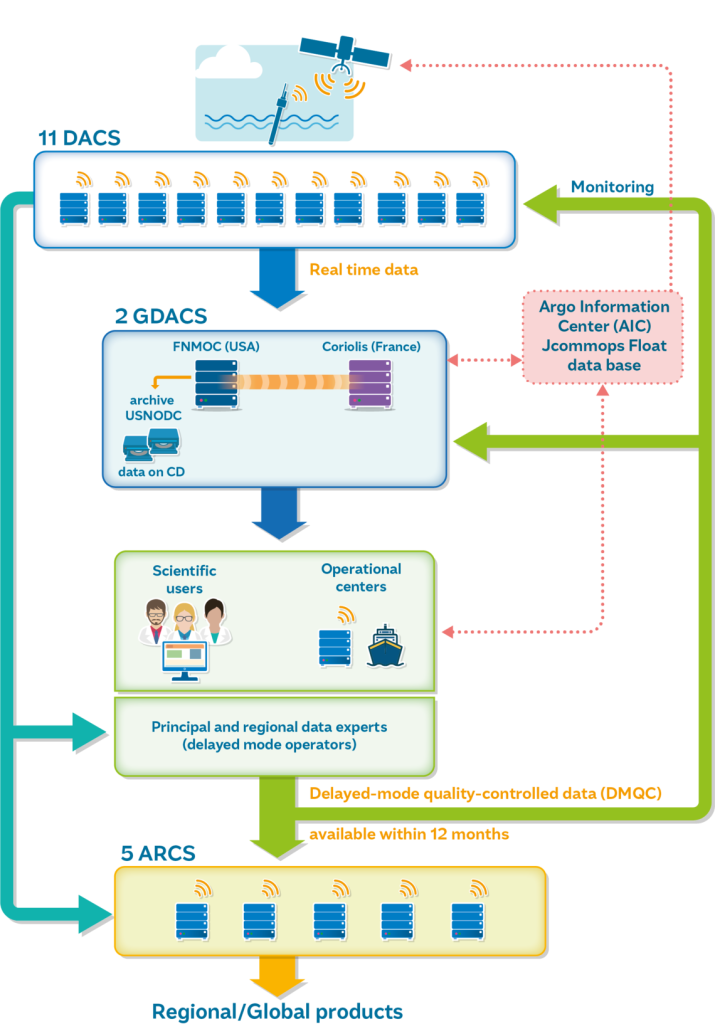
The international Argo Data System is based on two Global Data Assembly Centres, a series of 11 national Data Assembly Centres (DAC) and two Argo Global Data Assembly Centres (GDACs).
Once a float reaches the surface, it transmits its measurements and location via satellite. GPS is now the main positioning method, although some floats continue to use the Argos system. The measurements are received and processed by national Data Assembly Centres (DACs), while OceanOPS tracks the status and positions of the Argo fleet.
Before being made publicly available, the incoming profiles are first decoded and then pass through a standardised set of real-time quality control (RTQC) procedures at the DACs. These automated checks assess the observations for potential problems and assign quality flags or corrections where required.
The quality-controlled profiles are then forwarded to the two GDACs in Brest, France and Monterey, California. These centres maintain synchronised copies of the global Argo dataset, making the observations freely accessible online. The data are subsequently distributed to operational ocean and climate services through the Global Telecommunications System (GTS).
The Argo system is designed to move observations rapidly from the ocean to users, with a target of approximately 12–24 hours between transmission by the float and availability of the data.
The DMQC analysis of Argo data is performed around 1 year after float deployment. This process needs to be repeated every year (since the new data arrives) up to the end of the float life.